


Land Cover
| Data Notes | |
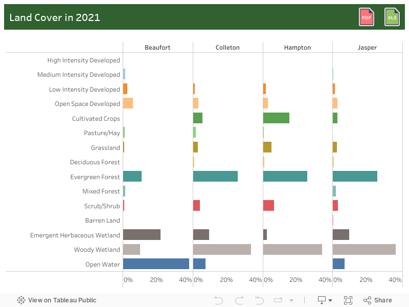
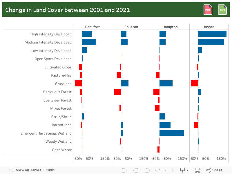
| Definition | Land Cover: Data on how much of a region is covered by built-areas, forests, wetlands, impervious surfaces, agriculture, and other land and water types. Water types include wetlands or open water. Land cover can be determined by analyzing satellite and aerial imagery. |
| Data Source | Multi-Resolution Land Characteristics (MRLC) Consortium |
| Last Updated | April 2024 |
