| Definition |
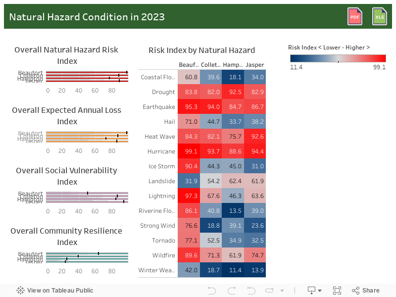
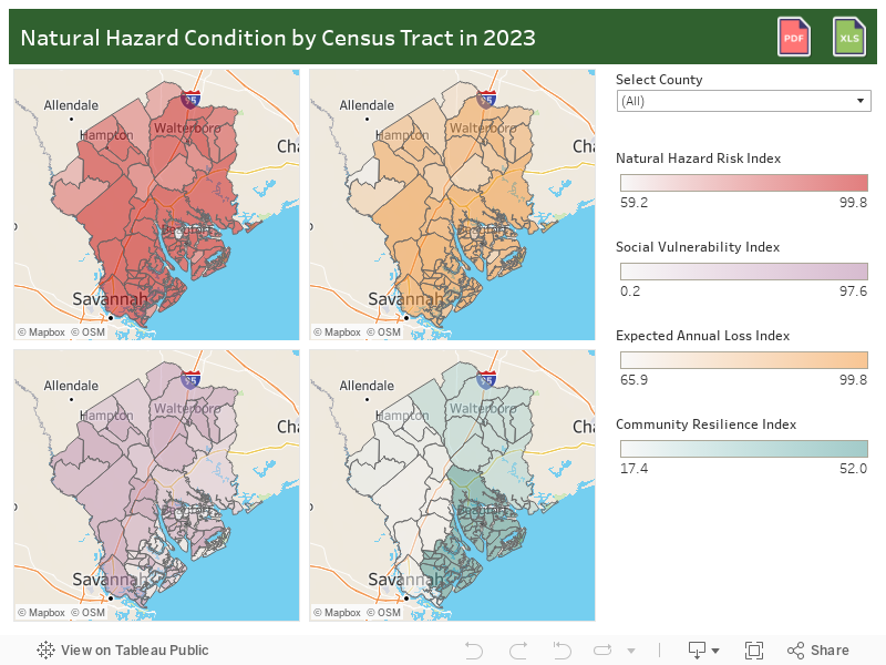
Risk Index: The risk index uses data from the National Risk Index (NRI) which is defined as the potential for negative impacts as a result of 18 natural hazards: Avalanche, Coastal Flooding, Cold Wave, Drought, Earthquake, Hail, Heat Wave, Hurricane, Ice Storm, Landslide, Lightning, Riverine Flooding, Strong Wind, Tornado, Tsunami, Volcanic Activity, Wildfire, and Winter Weather. The Risk Index includes three components: a natural hazards component (Expected Annual Loss), a consequence enhancing component (Social Vulnerability), and a consequence reduction component (Community Resilience).
- Expected Annual Loss (EAL) represents the average economic loss in dollars resulting from natural hazards each year. It is calculated for each hazard type and quantifies loss for relevant consequence types: buildings, people, and agriculture.
- Social vulnerability is the susceptibility of social groups to the adverse impacts of natural hazards, including disproportionate death, injury, loss, or disruption of livelihood.
- Community resilience is the ability of a community to prepare for anticipated natural hazards, adapt to changing conditions, and withstand and recover rapidly from disruptions.
Census Tract: A small, relatively permanent statistical subdivision of a county delineated by a local committee of census data users for the purpose of presenting data. Census tracts nest within counties, and their boundaries normally follow visible features, but may follow legal geography boundaries and other non-visible features in some instances, Census tracts ideally contain about 4,000 people and 1,600 housing units. |